Aerial Tramway
Calvary of Wejherowo
A concept for architectural and urban elements as part of the recreational infrastructure in the area of City Park and the Calvary in Wejherowo, Poland. Created as part of my MS Architecture graduate degree project in Gdańsk, 2016.
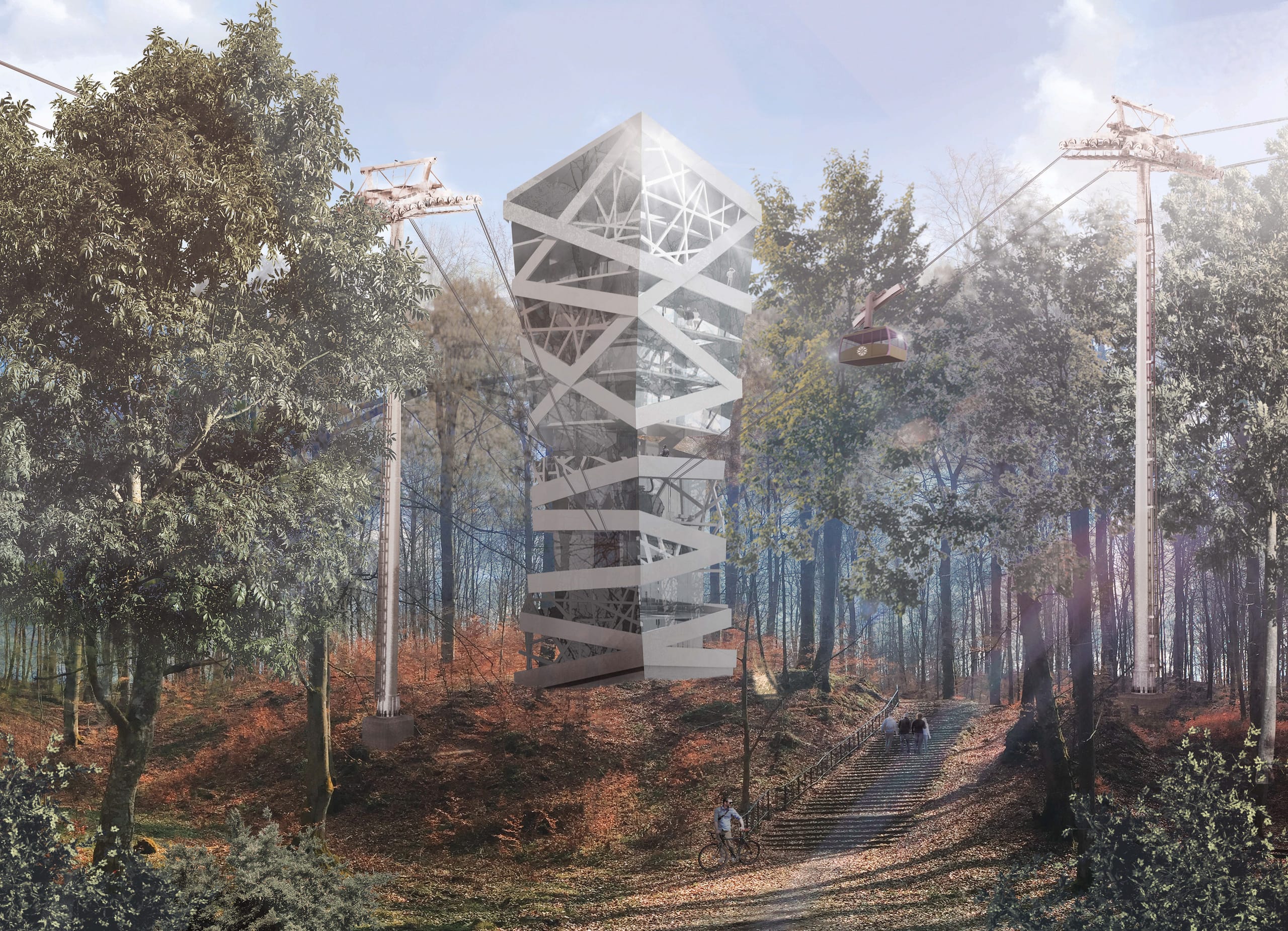
The project is a public building — an observation tower with aerial tramway service, located in the Calvary hills of Wejherowo. It focuses on introducing a new transportation system to the area, as well as an observation station for the local surroundings. The building includes a ticket office, waiting zones, two levels of aerial tramway, an outdoor garden, three levels of observation platforms, a café, and a restaurant at the top. The building would sit within the forest.
The project was recognized by the Dean’s Office as one of the Best Projects and received the highest grade.
Supervisor: Daniel Załuski PhD. Eng. Arch. / Reviewer: Ksenia Piątkowska PhD. Eng. Arch.
Software used: Autodesk Revit, AutoCAD, SketchUP, V-Ray, Adobe Photoshop & Adobe Illustrator
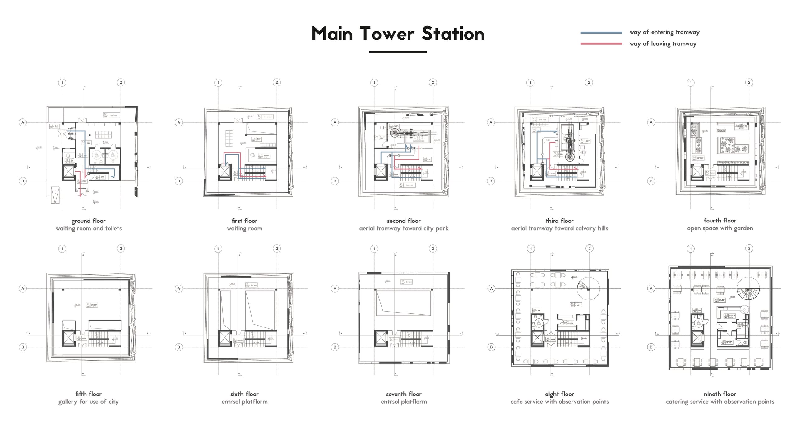
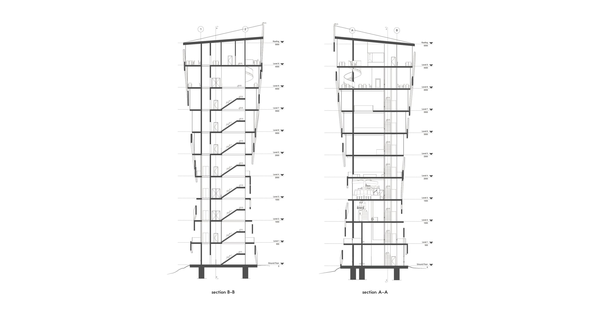
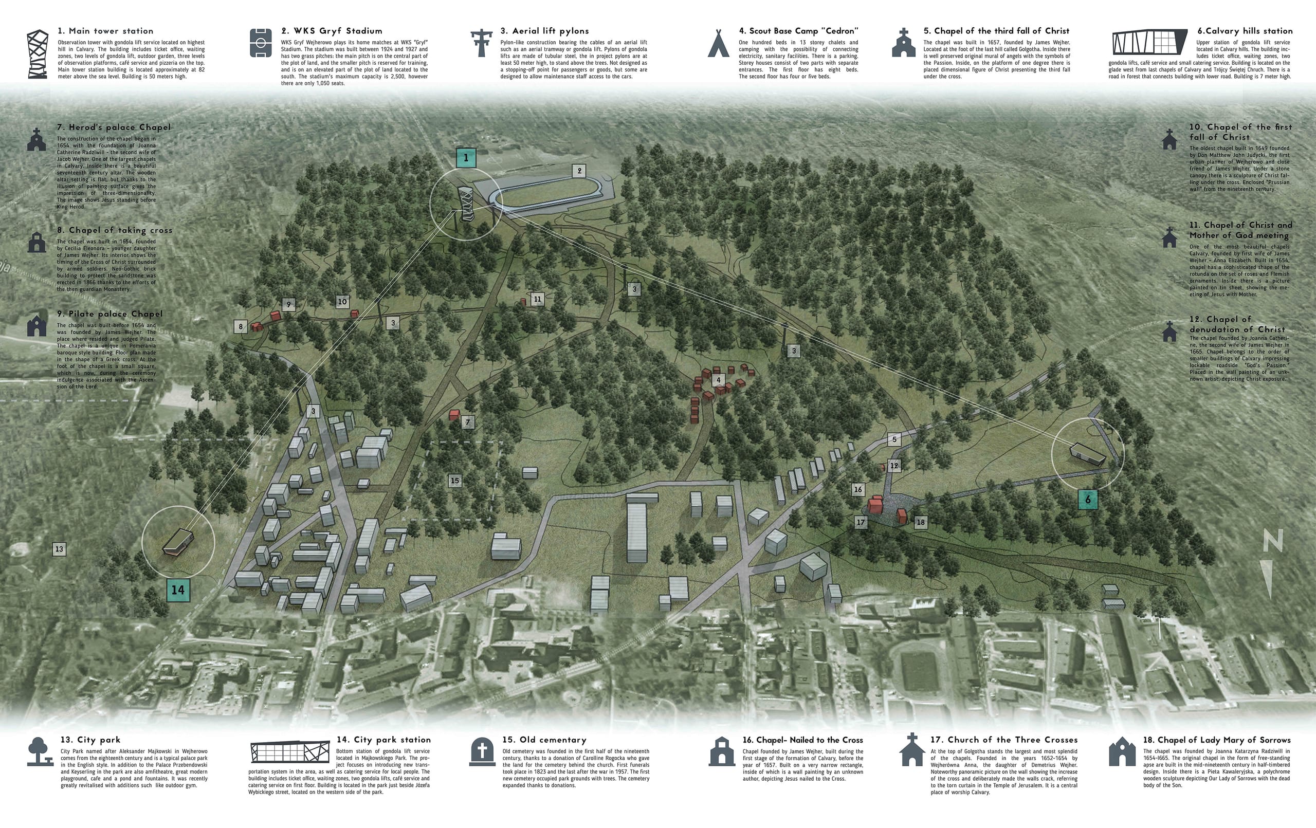
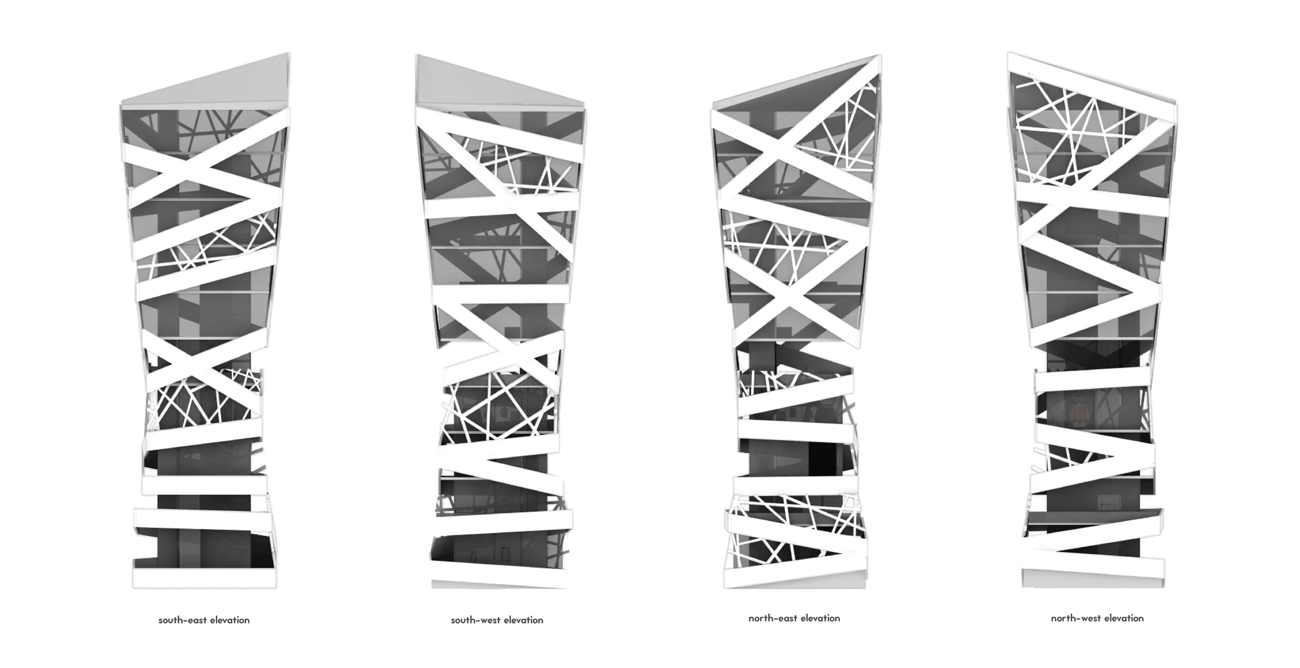
Main Tower Station: The observation tower’s site plan is based mostly on existing infrastructure. The existing road from the south needs to be reinforced so that ambulances and fire trucks can reach the building in an emergency. The area around the stadium and the tower gives vehicles room to make full turnarounds. The tower stands 50 meters above the existing ground level (around 90 meters above sea level), and two metal pillars would be placed to the north-west and north to stabilize the aerial tramway structure. A few trees would need to be cut down to make room for the tower’s foundations, which would be made of concrete pillars drilled into the ground.
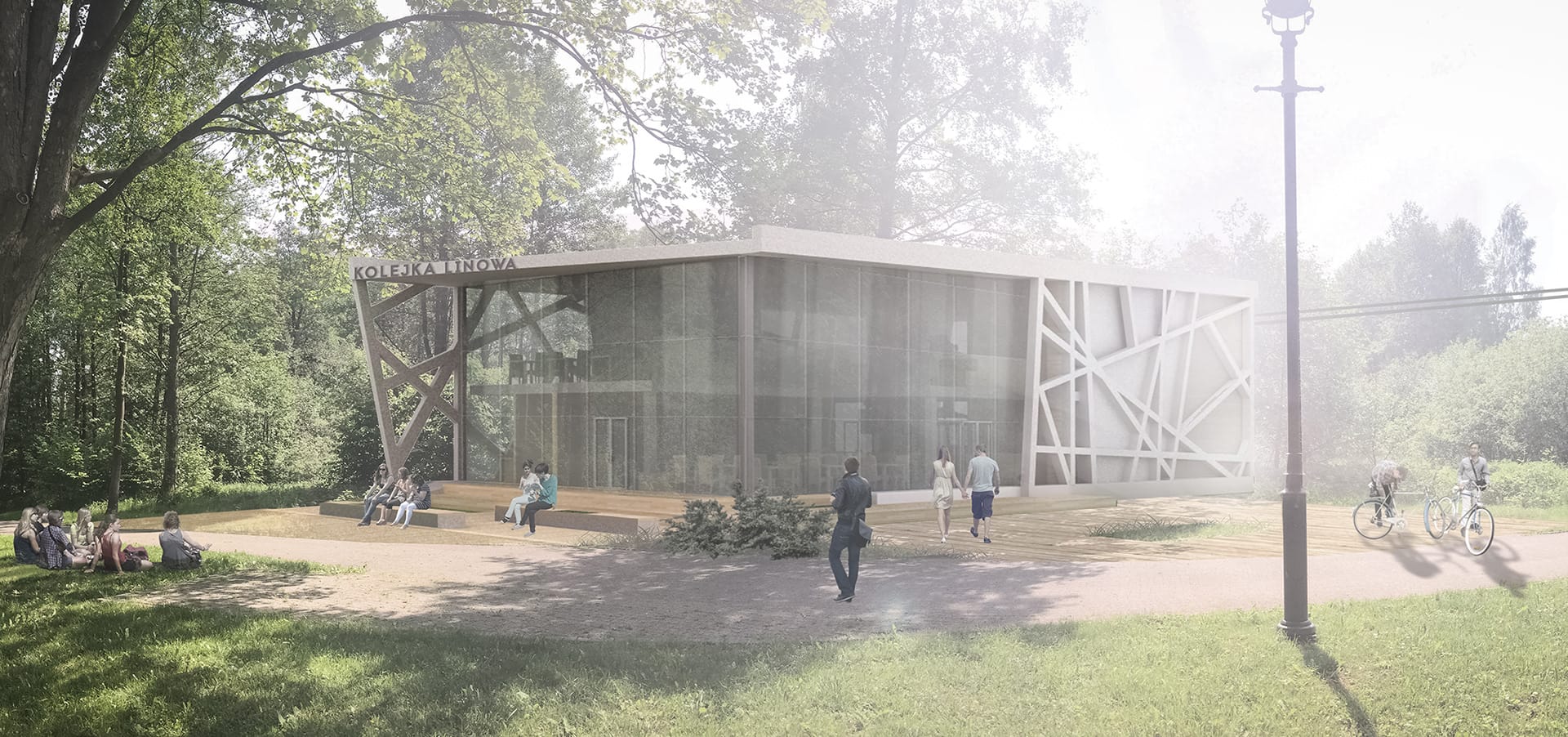
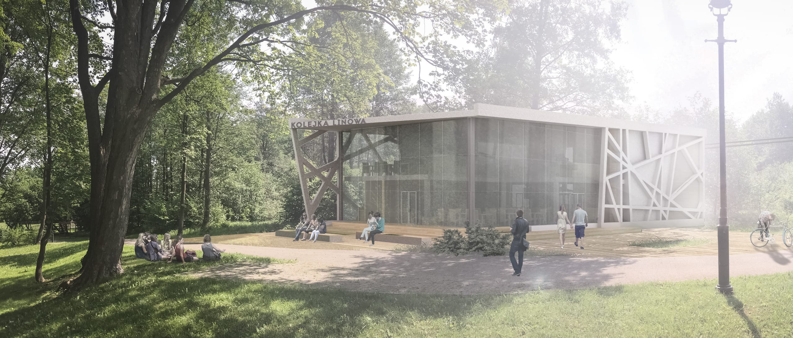
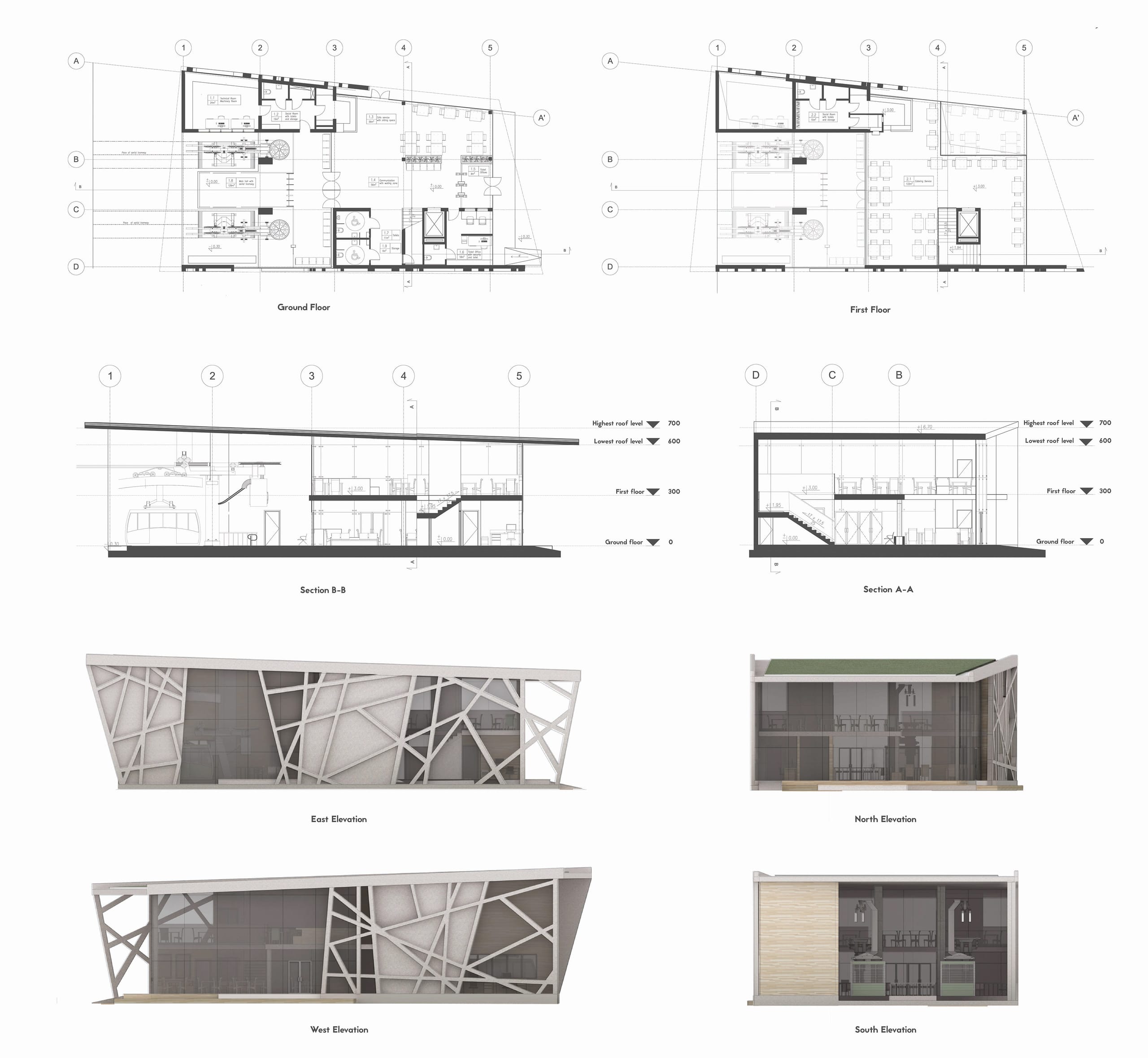
City Park Station: The second building is the lower station of the aerial tramway, located in Majkowskiego Park in Wejherowo. It focuses on introducing a new transportation system to the area, as well as a catering service for local residents. The building includes a ticket office, waiting zones, two aerial tramways, a café, and a catering service on the first floor. It sits in the park just beside Józefa Wybickiego Street, on the western side of the park.
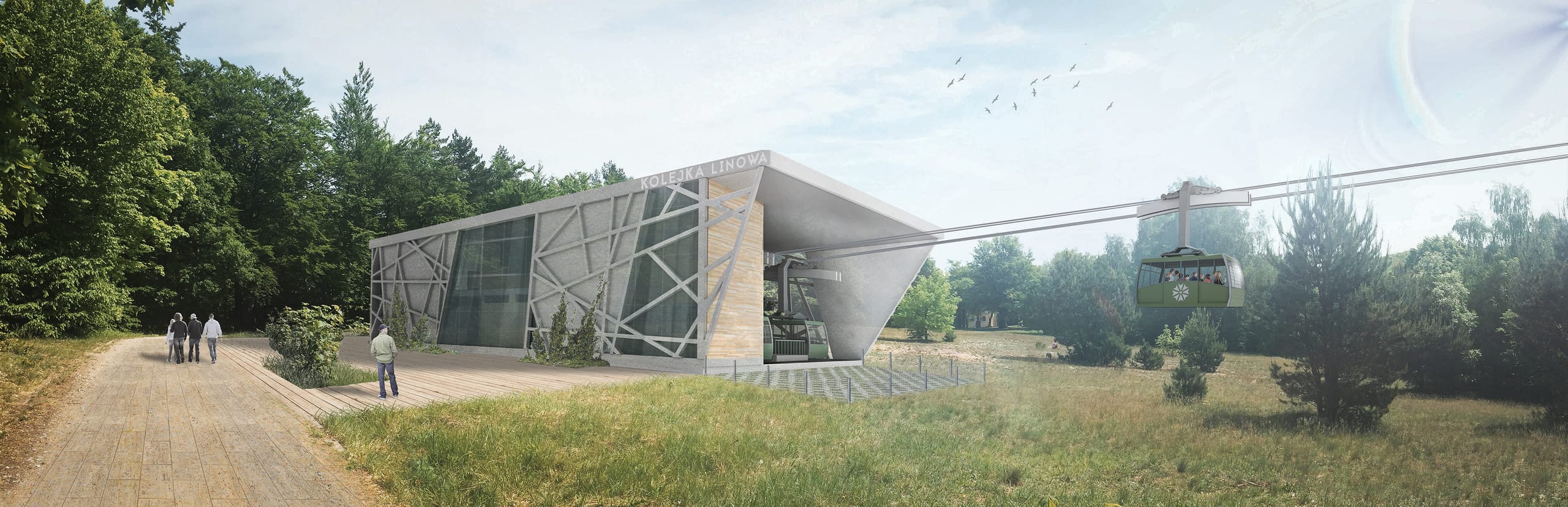
Calvary Hills Station: The last building is the upper station of the aerial tramway, located in the Calvary hills of Wejherowo. Like the lower station, it includes a ticket office, waiting zones, two aerial tramways, a café, and a small catering service. The building sits on a glade west of the last chapels of the Calvary and Trójcy Świętej Church. All the buildings are connected by the metal support pillars set throughout the Calvary forest. The exact locations of the pillars were specified by the architectural competition materials, along with other design guidelines.
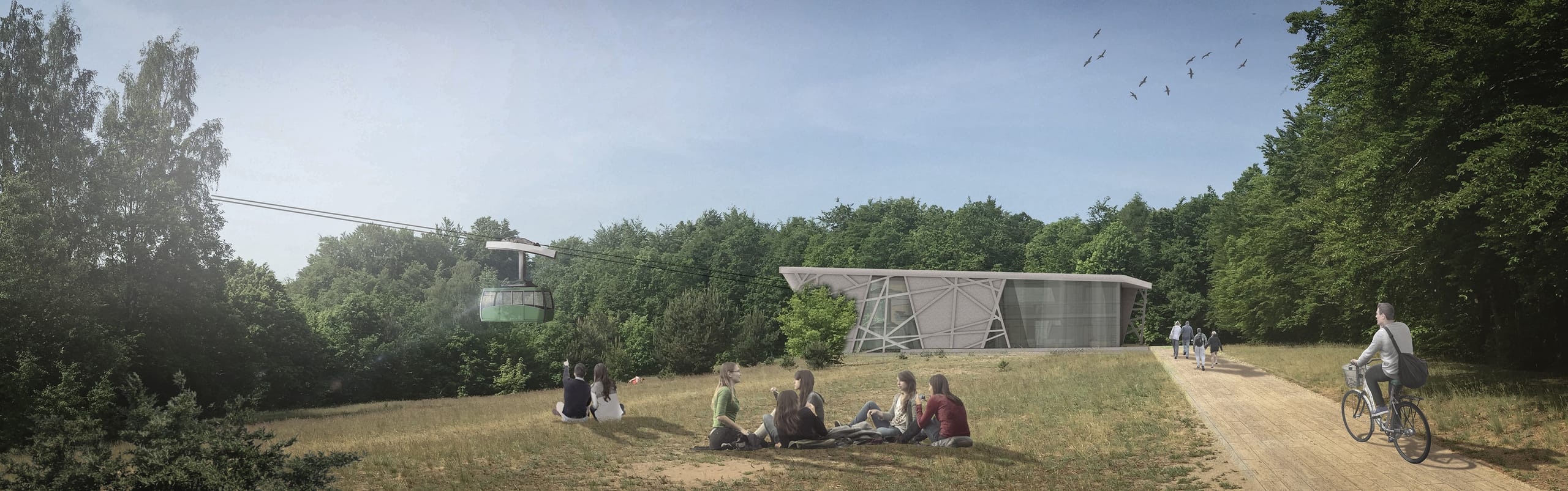
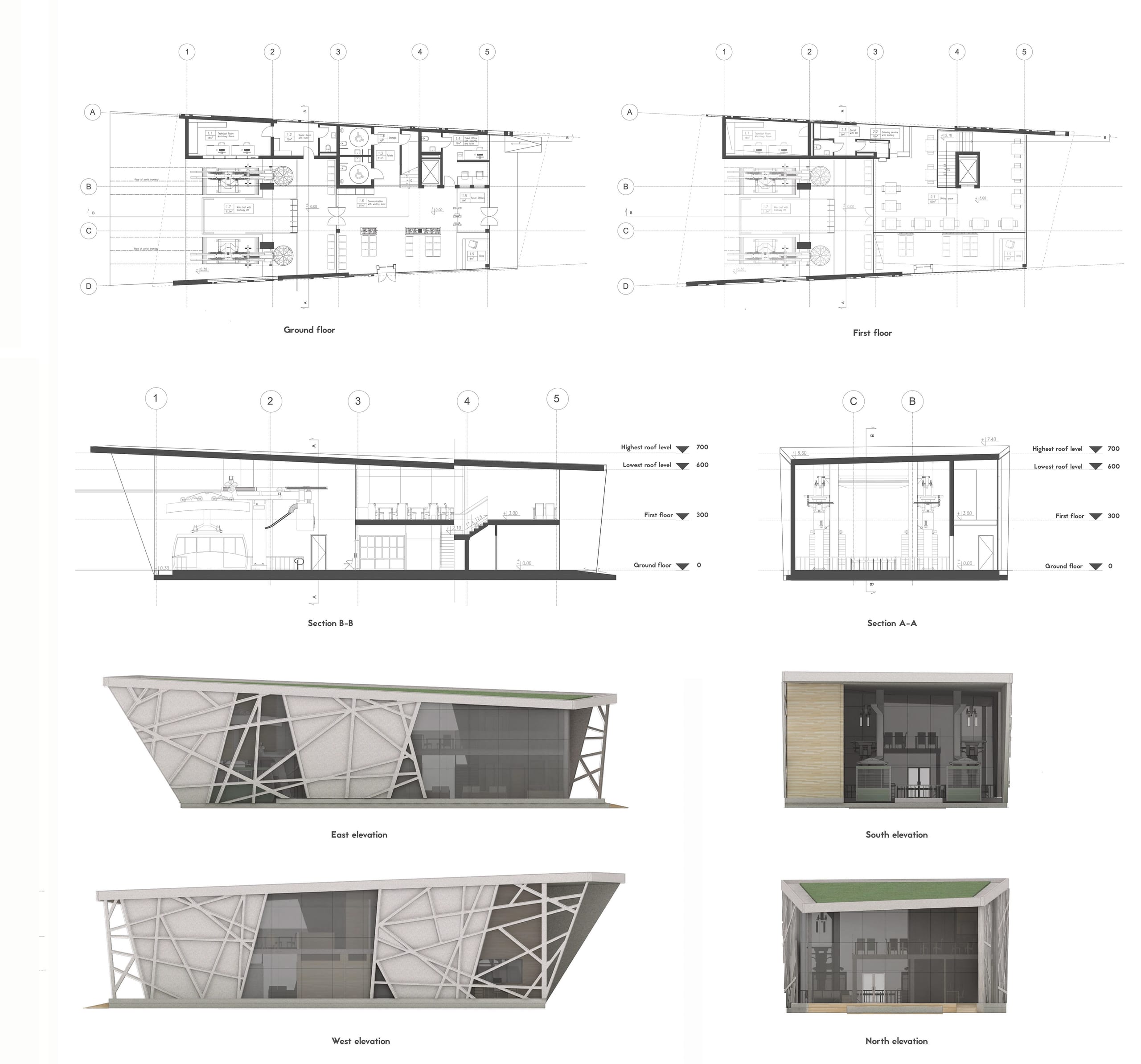
The stations are built from trapezoidal shapes, with walls of concrete and glass. On the outside, additional branches are added so that the stations connect aesthetically with the design of the tower. The interior walls are finished with light wood and gray/white concrete. The stations, like the tower, stand out, but the branch structure was created for ivy to grow on, so that each building can integrate with the surrounding greenery. Every wall of the stations is different. The roof of each building is covered with grass.
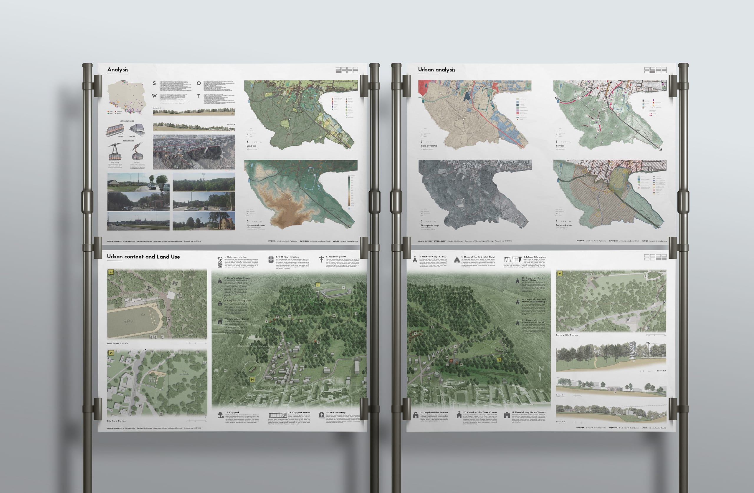
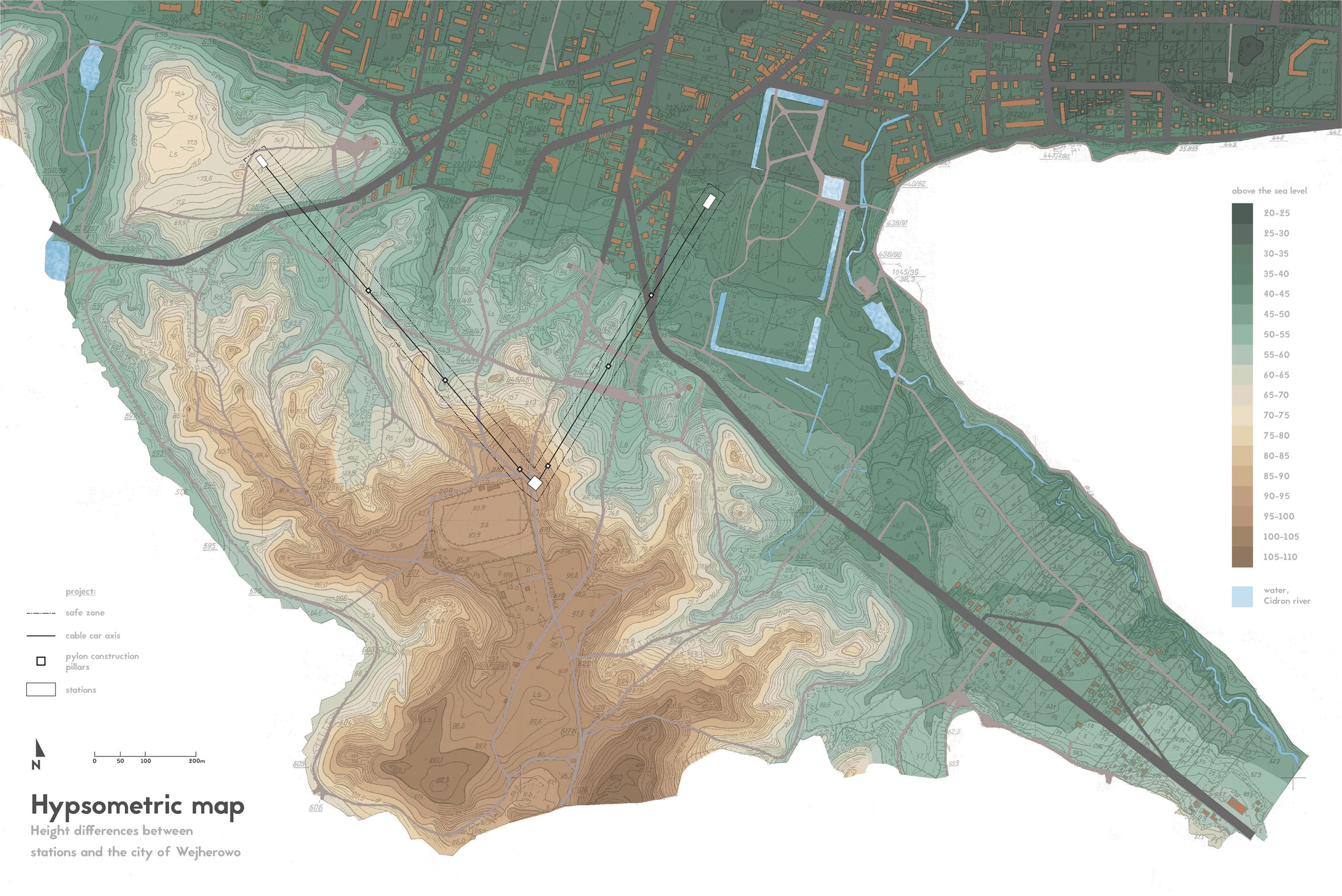
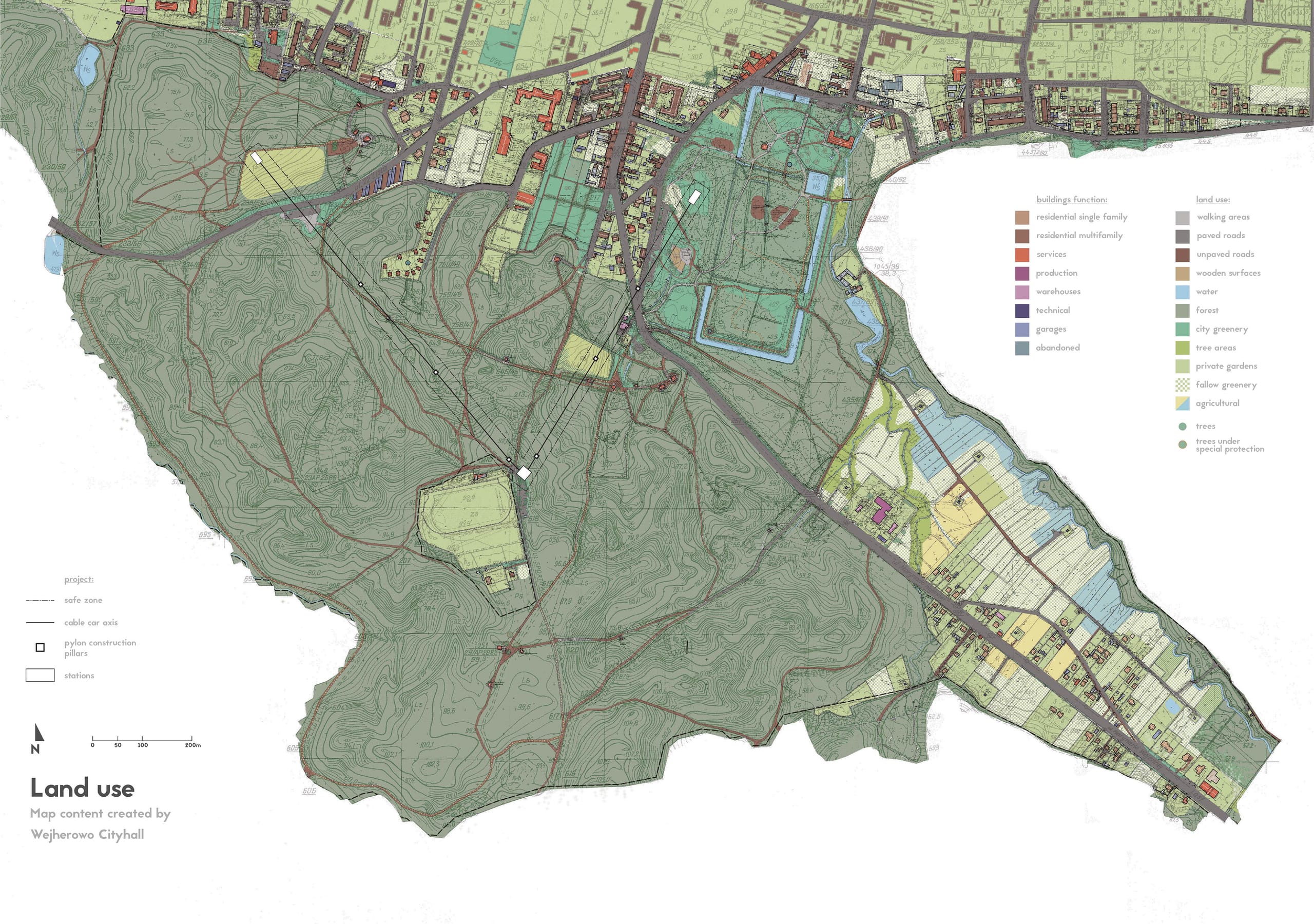
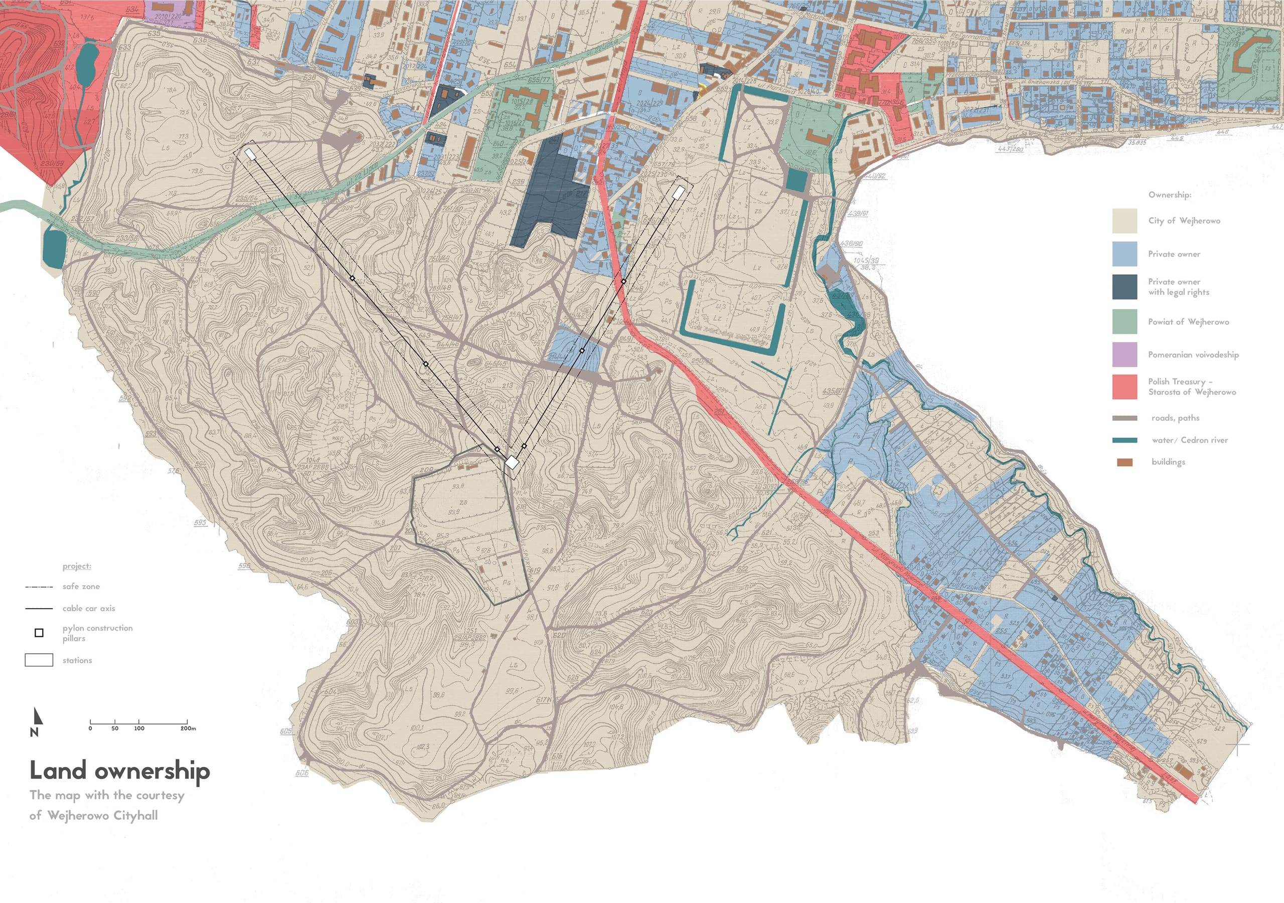
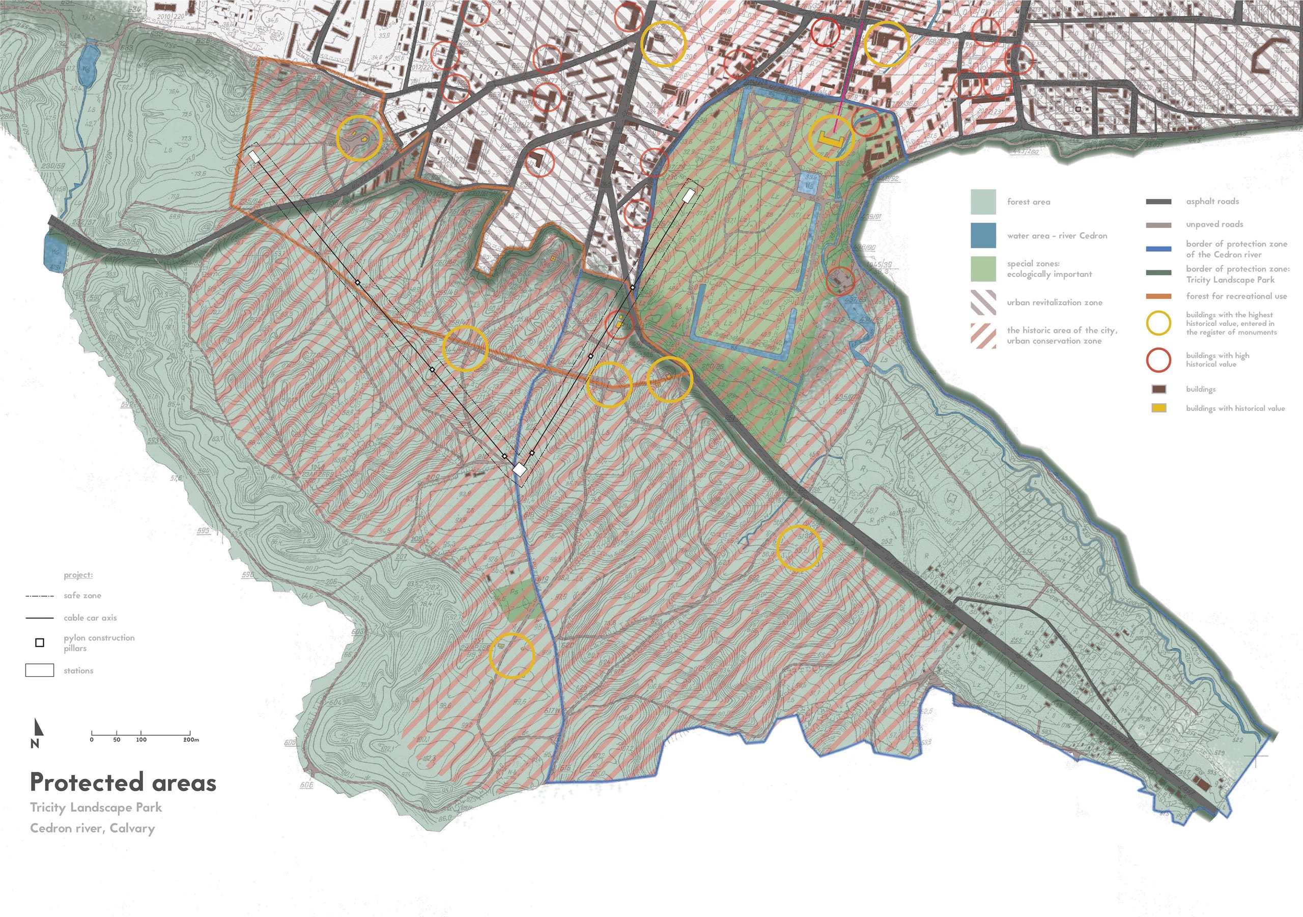
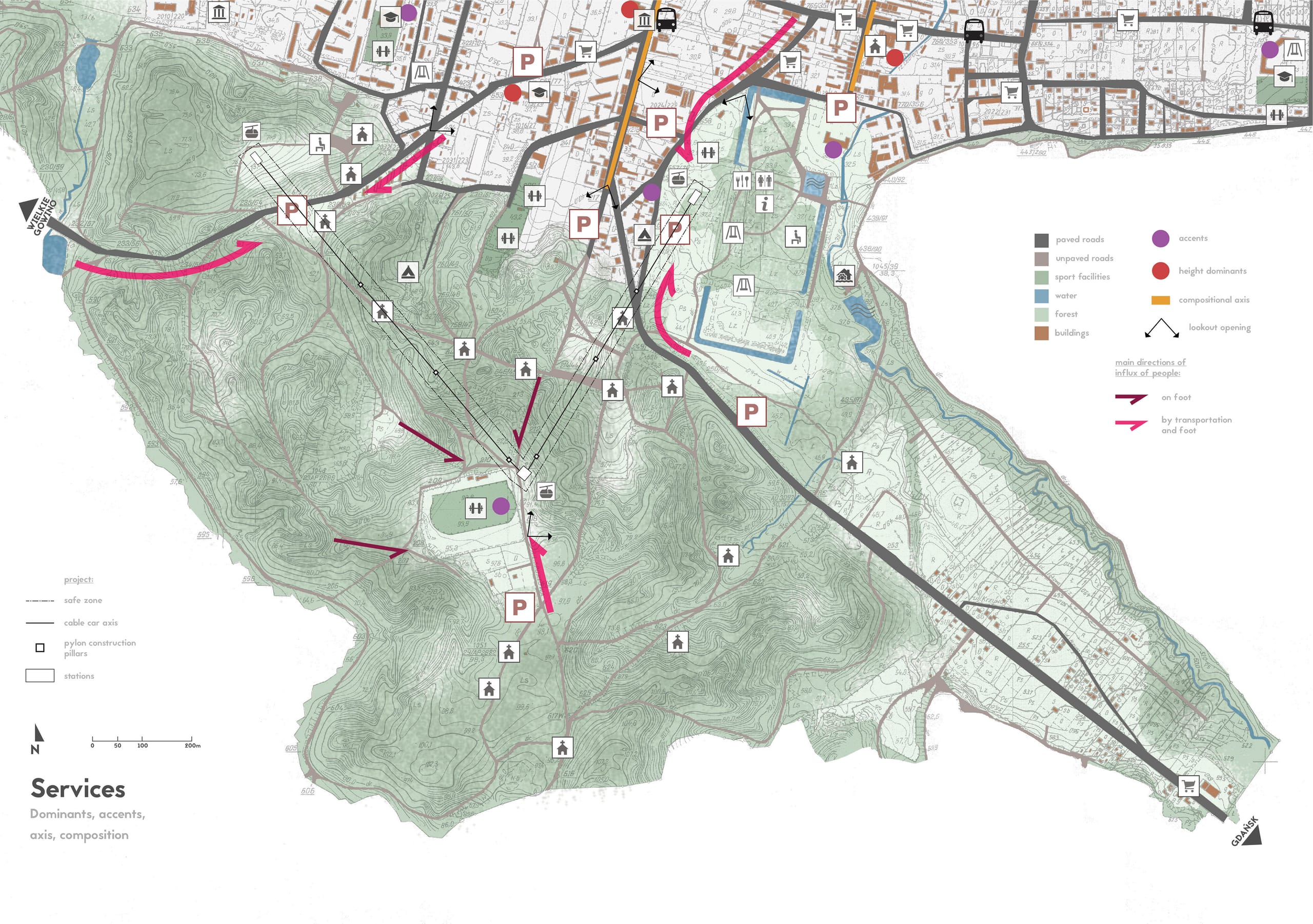
Urban analysis is an important part of the design process, which involves studying the existing urban structures within the city, the urban context, land use, differences in elevation, and much more. As part of the project, I created several maps, each focusing on a different aspect of the terrain. The analysis was also structured to anticipate future services, the use of the space, and the visual impact on the area.